Our Company is a leading developer of software and special purpose equipment both on domestic and foreign markets. We are committed to highest world standards of performance paying respect and attention to every client. We unlock the creative potential of our personnel and build corporate unity on the principles of openness and trust.
Geographic information systems
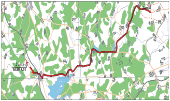
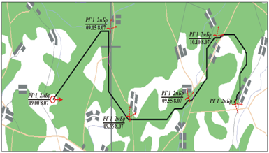
Optimal Route and Transportation Planning System
The System is designed for:
- calculation of the optimal route for maneuvering subunits based on the given terrain requirements and the movement parameters;
- determination of the optimal transportation plan providing exhaustive combat operation support.
The System allows setting the location of the initial and the final points of the route to be defined. It also sets the criteria system the defined route should meet. The System allows setting the location of the cargo warehouses and consumption sites which have procurement orders and calculation of the optimal cargo transportation plan.
The System calculates the optimal route between the specified sites; the length of the specified route; the optimal cargo transportation plan for the given warehouses and consumption sites; general efficiency of the determined transportation plan.
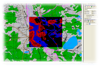
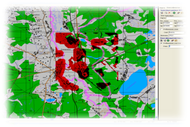
Classification and Territory Site Selection System
The System is designed to classify and select territory sites with a number of given characteristics for military objects deployment tasks.
The System allows analyzing the territory and setting the criteria which serve as the basis for the territory analysis. The System specifies the territory classifier settings basing on the analysis performed.
The System defines the territory which fully corresponds to the criteria system or partially meets the given criteria, i.e. classifies the territory in accordance with the criteria system and the classifier settings.
Specific feature of the both Systems: any digital terrain map data can be used as a criterion for route determination, territory analysis and evaluation. All calculations are carried out and their results are displayed on the background digital terrain map.
Special software was developed by engineering order in accordance with cartographic authorities of Ministry of Defence and adopted by MOD.


Siteks